notes.husk.org/likes
images.
tagged aerial view.
page 8 of 13 with 305 images.
aerial view
satellite imagery
coastal city
airport runway
urban landscape
harbor
cityscape
top-down view
coastline
urban planning
Daily Overview
aerial view
railway yard
train tracks
freight cars
logistics
transportation
industrial
railroad
rail transport
infrastructure
Daily Overview
architecture
modern architecture
skylight
cityscape
urban landscape
park
greenery
aerial view
contemporary design
roof
markasaurus
aerial view
satellite imagery
aquaculture
fish farm
ponds
coastal
geometric patterns
top-down view
water
landscape
Daily Overview
clouds
sky
aerial view
cloudscape
blue sky
nature
high altitude
fluffy clouds
atmosphere
view from above
nothing in particular
aerial view
drone photography
lake
shoreline
forest
nature
landscape
water
greenery
pattern
Daily Overview
aerial view
satellite imagery
evaporation ponds
salt pans
desert landscape
aquaculture
reservoir
top-down view
arid environment
geometric shapes
Daily Overview
urban planning
architectural rendering
aerial view
city grid
black and white
master plan
urban design
cityscape
monochrome
bird's eye view
Milton Keynes: Utopian Vision
highway interchange
cloverleaf junction
vintage illustration
retro art
traffic flow
aerial view
mid-century style
road network
automobiles
landscape illustration
things magazine tumblr
refinery
oil storage tanks
aerial view
industrial plant
petrochemical
energy infrastructure
storage depot
chemical processing
top-down view
industrial complex
Daily Overview
airport
aerial view
runway
aviation
satellite imagery
infrastructure
transportation
aircraft
terminal
top down
Daily Overview
aerial view
architecture
modern architecture
urban landscape
drone photography
top-down view
cityscape
geometric architecture
building design
contemporary architecture
Daily Overview
aerial view
highway interchange
infrastructure
urban planning
transportation
road network
spaghetti junction
civil engineering
top-down view
trafficway
Daily Overview
new york city
aerial view
transit map
subway lines
manhattan
cityscape
urban landscape
transportation network
infrastructure
map overlay
Buzz Andersen
4 images
runway
aerial view
satellite imagery
airport
aviation
airstrip
top-down view
tarmac
infrastructure
transportation
STML
aerial view
black and white
grainy
landscape
monochrome
vintage
top-down view
high contrast
texture
abstract
Dan W, Software Developer
central park
new york city
manhattan
aerial view
cityscape
skyscrapers
urban landscape
drone photography
bird's eye view
urban jungle
Dan W, Software Developer
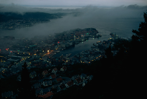
aerial view
cityscape
foggy
harbor
twilight
mist
coastal city
night photography
port
urban landscape
there's a rumbly in my tumbly
printmaking
etching
monochrome
cityscape
architecture
rooftops
aerial view
geometric patterns
black and white
graphic art
Tecznts
san francisco bay
satellite view
california
coastline
pacific ocean
aerial view
geography
earth observation
topography
landscape
Landsat
mountains
glacier
aerial view
satellite imagery
route
alpine landscape
path
snowy peaks
topography
navigation
The New Aesthetic
aerial view
satellite imagery
salt flat
desert landscape
top view
dry lake
terrain
nature
abstract
landscape photography
STML
architecture
skyscraper
black and white
urban photography
aerial view
brutalism
cityscape
geometric
monochrome
high angle
Fuck Yeah Brutalism
concentrated solar power
solar thermal energy
heliostat field
renewable energy
aerial view
solar tower
solar farm
clean energy
solar mirrors
sustainable technology
Dan W, Software Developer